Friday, October 25, 2013

Tales of Two Paddles

Our last camp and paddle trip to Merchants Millpond State Park yielded three great paddle days. So when we set out earlier this week for another trip to MMPSP we had high hopes.

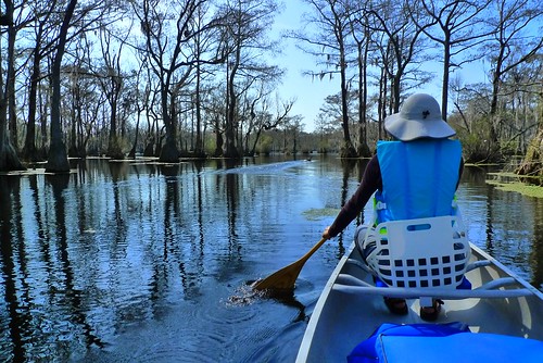
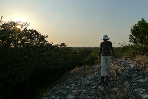
Well, we loafed at the campsite Monday afternoon, did not paddle, and enjoyed the solitude of being the only campers in the park. Tuesday was overcast with threatening rain but we put the canoe in the water anyway. The millpond was choked with duckweed and we struggled to make it back to Bennett's Creek. The water was high and we made good progress up the creek, but after one slow detour around a beaver dam and a portage (with lunch break) we turned around, failing to beat last Spring's upstream distance record. However, on the way back we were rewarded with an up-close look at a bald eagle; first flying low beside us through the trees, then a few minutes later circling around to our left side with a limp heron hanging from his talons. Wow!

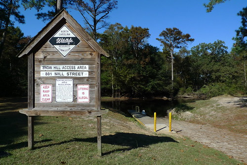
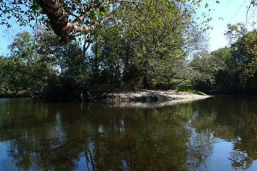
We were up early Wednesday morning but the light rain and cold temps drove us back to Raleigh with dry paddles. However, since the canoe was still on top of the car and Thursday looked like a good day to paddle, we headed 80 miles east on Thursday morning to get in a day paddle on Contentnea Creek, upstream and back, from the Snow Hill boat ramp. It was a very nice paddle, reminding Sun-Ling and I of the blackwater creeks of Florida. The water level at the Hookerton gauge was 5.31 feet and we paddled over most of the downed trees but did have to portage a downed tree around the oxbow. We'll definitely be back to the Contentnea which has about 80 miles of navigable waters.
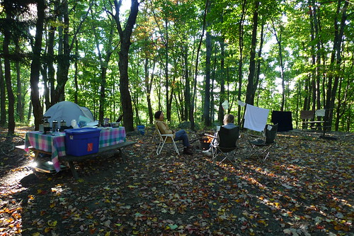
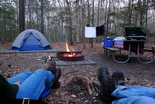
Campfire.
Campfire - Merchants Millpond State Park - Gatesville, NC

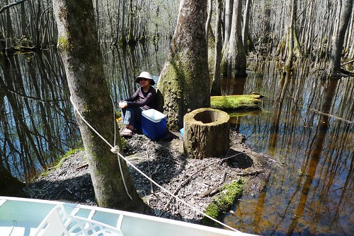
Bennett's Creek Portage and lunch.
Lunch Spot - Up Bennett's Creek - Merchants Millpond State Park - Gatesville, NC

Up Bennett's Creek - Merchants Millpond State Park - Gatesville, NC

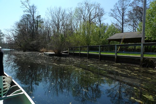
Duckweed on the Millpond.
Merchants Millpond State Park - Gatesville, NC

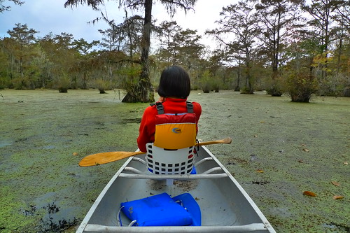
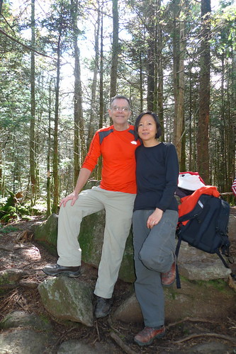
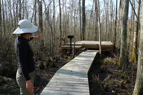
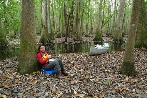
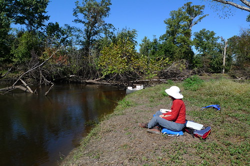
Contentnea Creek Portage and lunch.
Lunch Spot - Cententnea Creek - West of Snow Hill Put-in

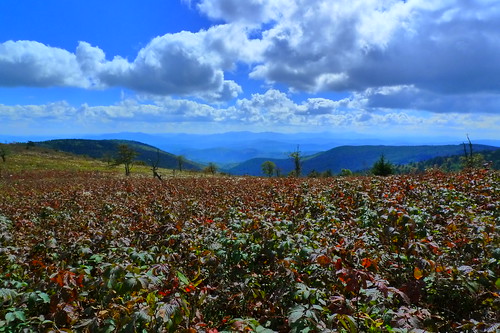
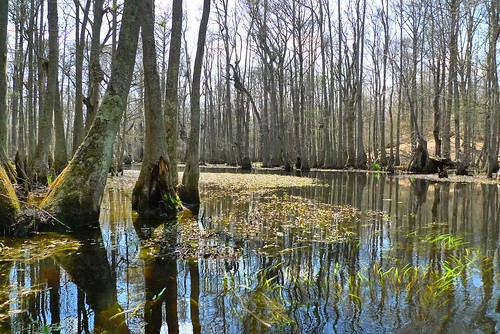
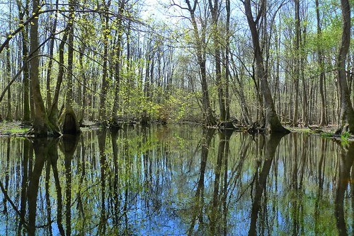
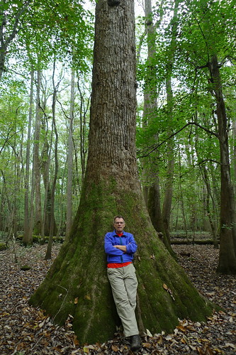
Florida? No. It's North Carolina.
Cententnea Creek - West of Snow Hill Put-in

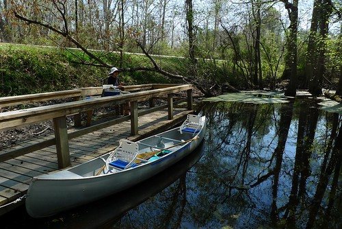
The put-in at Snow Hill.
Boat Ramp - Snow Hill, NC

Wednesday, October 09, 2013

Grayson Highlands State Park

Recently back from a great camping and hiking trip to Grayson Highlands State Park located near Mouth of Wilson, Virginia.

The weather was perfect, the campsite great, the sunrises awesome, and the hiking fabulous.

Here's a photo of us at the top of Mt Rogers, the highest point in Virginia, and claims to be "highest state highpoint east of South Dakota that doesn't have a road leading to its summit". How about that? ;-)

Atop Mt Rogers @ 5,728' (1,746 m)- The Highest Point in Virginia - Mt. Rogers Recreation Area - near Mouth of Wilson, VA

Morning coffee at our campsite (joined by our friend Dayle).
AM - Grayson Highlands State Park - near Mouth of Wilson, VA

There's no view from the top of Mt Rogers but here's the view from the nearby Appalachian Trail.
View from just off the Appalachian Trail - Mt. Rogers Recreation Area - near Mouth of Wilson, VA

The rest of the photos are here.

Tuesday, April 23, 2013

Merchants Mill Pond Paddle and Camp

Last week we hauled our canoe and tent over to Merchants Millpond State Park and enjoyed some very fine camping and paddling.

One day we paddled east through the millpond, through Lassiter swamp and up Bennett's Creek for about two miles before turning around. The high water this year made the paddle up Bennett's Creek a record setter, beating by far (almost a mile I reckon) our previous attempts. Highlights were lunching on an old, now flatten, beaver lodge and spotting a yellow-crowned night heron.

The next day we put in for the first time at the Gatesville dock/ramp and paddled up the Bennett's Creek Paddle Trail to the Merchants Millpond dam and back. Another great paddle with many beaver lodges, jumping fish, and another great lunch at the turn-around. This paddle trail also has a couple of platforms for canoe-camping.

In the map below, the first paddle is the green line; the second the red line. Our campsite is circled in yellow and the orange X marks our favorite lunch spot.

Merchants Millpond State Park Map

Hanging out back at camp after a day of paddling.
Campsite #19 - Merchants Millpond State Park - near Gatesville, NC

Fav lunch spot; although this photo was taken while we had only stopped for a snack and leg stretch....Our canoe is barely visible at the water's edge.
Fav Lunch Spot - Merchants Millpond State Park - near Gatesville, NC

We startle a goose.
Goose! - Merchants Millpond State Park - near Gatesville, NC

Near the point where Lassiter Swamp ends and Bennett's Creek begins.
Entrance to Bennett's Creek - Merchants Millpond State Park - near Gatesville, NC

This old remnant of a beaver lodge on the upper section of Bennett's Creek made a perfect lunch spot.
Lunch on Bennett's Creek - Merchants Millpond State Park - near Gatesville, NC

Somewhere up Bennett's Creek.
Somewhere Up On Bennett's Creek - Merchants Millpond State Park - near Gatesville, NC

Second day's lunch spot was at the turnaround; that is, eastern put-in of the paddle trail.
Merchants Millpond State Park - Bennett's Creek Put-in

Part of the canoe camping platforms on the Bennett's Creek Paddle Trail.
Canoe Camping Platform - Bennett's Creek Paddle Trail - near Gatesville, NC

The Gatesville dock.
Bennett's Creek Floating Dock - Gatesville, NC


And all of the flickr photos are here.

Monday, April 01, 2013

A New Look

The blog has been redesigned with a new cleaner look and tools that make it easier to find things:
  • there is a blog search box on the right-hand side
  • posts are listed by country and topic on the right-hand side
Comments and corrections welcome!

Friday, March 08, 2013

Back Home

After two uneventful bus rides, and two short flights, we are now back home in Raleigh - trip over. Once again our house survived months without us (thanks Karen and Yates!), and our friends and neighbors have been most helpful getting us back in the swing of Carolina living.
-john and sun-ling

Sunday, March 03, 2013

Valladolid

Our last night in Mexico was spent in Valladolid strategically for us located about halfway between Merida and Cancun, and just a 3 hour bus ride to the Cancun airport. By having a beautiful colonial city center, and being less than an hour from the most famous Mayan ruin, Chichen-Itza, Valladolid gets many overnight and tour-grouping-day-tripping tourists - more than we expected to see.

And another tasty noon-time breakfast.
Valladolid, Yucatan, Mexico

One other attraction of Valladolid is the many cenotes (sinkholes).
Valladolid, Yucatan, Mexico

The Cathedral.
Valladolid, Yucatan, Mexico

Late afternoon tour groups.
Valladolid, Yucatan, Mexico

Murals in a city government building.
Valladolid, Yucatan, Mexico

Iglesia de la Candelaria
Valladolid, Yucatan, Mexico

Convent de San Bernardino de Siena.
Valladolid, Yucatan, Mexico

Saturday, March 02, 2013

The Pyramids of Izamal

Izamal is located on the Yucatan Peninsula, about 45 kms east of Merida and uniquely has Mayan pyramids right in the town center, two of which are very large. Also, the Franciscan church and monastery are built on top of a the ruins of a pyramid. Izamal is definitely worth a day-trip from Merida, or an overnight stay (which we did), and it is being considered for UNESCO World Heritage status. The write up for that is here.

Nothing like a tasty breakfast at noon to get one going for the day.
Deseyuno - Izamal, Yucatan, Mexico

The streets of Izamal.
Izamal, Yucatan, Mexico

Convento de San Antonio de Padua was built on top of the destroyed Mayan Acropolis called Ppap Hol Chak.
Izamal, Yucatan, Mexico

Izamal, Yucatan, Mexico

The view from the top of Pyramid Itzamatul, looking northwest to Pyramid KinichKakMo, the largest of the pyramids.
Izamal, Yucatan, Mexico

The view from the top of the great pyramid KinichKakMo. The grassy area below is part of the pyramid which extends to the yellow buildings in the distance. The building with the yellow tower and large courtyard is the Convento of San Antonio de Padua.
Izamal, Yucatan, Mexico

And more views of and from KinichKakMo.
Izamal, Yucatan, Mexico

The lower grassy area is part of the pyramid.
Izamal, Yucatan, Mexico

Izamal, Yucatan, Mexico

Our hotel was built on top of and in pyramid Hun Pik Tok.
Izamal, Yucatan, Mexico

Pyramid Chaltun Ha is a few blocks outside town.
Izamal, Yucatan, Mexico

Sunset view from the Monastery walls.
Izamal, Yucatan, Mexico

And the rising moon.
Izamal, Yucatan, Mexico

Convento de San Antonio de Padua plus roosting birds.


Outing from Merida: Acanceh

In 2003 we went to a few of the Mayan sites near Merida (Uxmal, Kabah, Labnah, Sayil). Given the 100 degree heat, we decided to limit our outing to a nearby small town of Acanceh where a ruined pyramid stands on the same square as the church. The town turned out to be only mildly interesting, but we were fascinated with the local rickshaw taxis (see video below). We had thought we would have seen all possible permutations of the 3-wheeled rickshaw. Here it was, a new variation: rear wheel, drive train and steering from a motorcycle; front 2 wheels of a 3-wheeled, front-loading bicycle. And the popularity of it; it seems that one either owns one, or works one, or rides in one. They are as ubiquitous as the car in Raleigh.

The plaza in Acanceh with main church center and small chapel at left.
Acanceh, Yucatan, Mexico

The plaza with pyramid ruins at left, the market at near right with the church behind.
Merida, Yucatan, Mexico

The plaza with the market to the right and the pyramid ruins to the center back. The main church is out-of-view right.
Merida, Yucatan, Mexico

Merida, Yucatan, Mexico

View from ruins back to the plaza.
Acanceh - Merida, Yucatan, Mexico

Inside the church.
Merida, Yucatan, Mexico

Here's the video of the rickshaw taxis.


A couple more taxi photos.
Merida, Yucatan, Mexico

Merida, Yucatan, Mexico

Merida - Architecture

I had too many 20th-Century modern architecture photos from Merida to put in the previous post, so here they are.

Several Art Deco and Modernist buildings in Centro.
Merida, Yucatan, Mexico

Cine Teatro Merida - Art Deco - 1949.
Merida, Yucatan, Mexico

Merida, Yucatan, Mexico

Edifico La Nacional - Carlos Castillo Montes de Oca - 1936.
Merida, Yucatan, Mexico

Edifio Las Monjas - 1948.
Merida, Yucatan, Mexico

The former Cine Alcázar is now a parking garage.
Ex-Cine Alcázar - Merida, Yucatan, Mexico

Tropicalista!.
Merida, Yucatan, Mexico

And another cluster to the west near Parque de la Paz.

Facultad de Medicina.
Merida, Yucatan, Mexico

Merida, Yucatan, Mexico

Merida, Yucatan, Mexico

The old 1880's train station has recently been renovated and houses the Escuela Superior de Artes de Yucatán
Merida, Yucatan, Mexico

The Mayan Revivalist Monumento a la Patria - Manuel Amábilis - 1950's
Merida, Yucatan, Mexico

The Bellas Artes Primary School in Barrio Santiago - circa 1909.
Merida, Yucatan, Mexico

And the Cine Rex across the square.
Merida, Yucatan, Mexico

Most Recent Post

Kandy: Tooth Relic Temple

According to the Tooth Relic Temple website , on Wednesdays there is a ritual of tooth washing, in addition to daily rituals. What we had no...

Most Popular Posts of Last 30 Days