If a sight is not mentioned in an older guidebook, then it's probably not worth seeing, right? So when we set off from Santa Ana for the only recently touted Ruta de las Flores (Route of the Flowers) we were not sure what to expect. The Ruta is described as a stretch of road, 36 kms long, linking quaint villages with scenic views of volcanoes, coffee fields, and flowers.
Since we are traveling by bus (not car), we parked ourselves in Ataco, and day-tripped one day to Apaneca, and another to Juayua (why-you-a).
Turned out to be a great choice to make Ataco our home, as it has many of the things we like in a town: a family-run hotel in a old building, a local market, a pleasant town square, drinkable tap water, street food, good transportation, nearby day hikes, a mirador, great weather, reasonable car traffic, and locals enjoying themselves. It does not have a river (or lake), sights, or lots of great architecture, but it does have murals.
In cool (~4500 ft elev) Apaneca, we hiked up to Laguna Verde, returned, and enjoyed a great lunch at the market.
Juayua was hot, and busy, and since we didn't hit it on the weekend food fair, a bit dull.
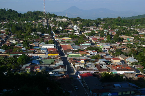
Ataco as seen from the mirador.
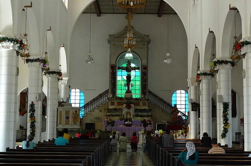
The church in Ataco. [Bonus points for spotting a person in this photo.]
Our favorite "bread lady" in Ataco. She carries that bread basket on her head all over town.
Papas with ketchup, hot sauce, and grated cheese from our fav papas vendor.
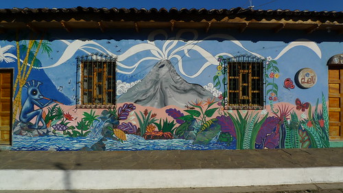
A part of one of the many murals in Ataco.
Sun-Ling and I having some Trompe L'oeil fun with a mural in Ataco.
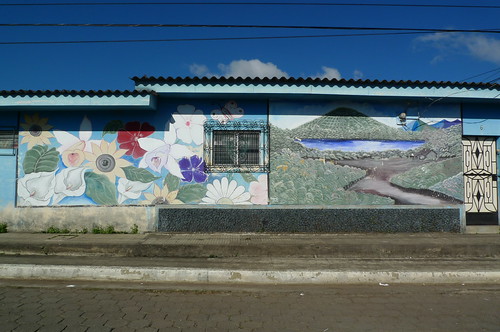
A mural in Apaneca.
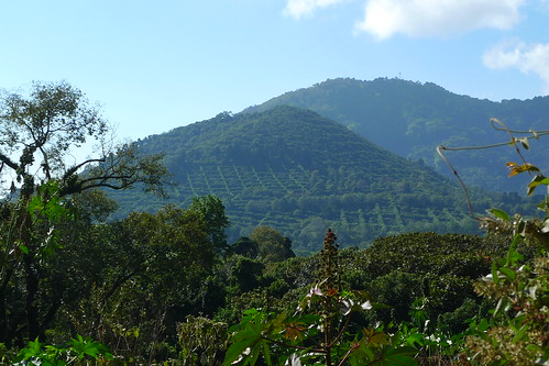
Coffee fields "grid" the slopes around Apaneca.
Laguna Verde - Apaneca.
Vegetarian Lunch - Apaneca, El Savador
Parque Central - Juayua.
The church in Juayua is known for its Christo Negro image over the altar.
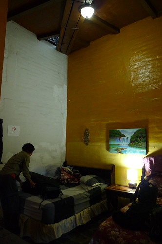
And finally, our hotel room at Hotel Villa Santo Domingo in Ataco.
Sun-Ling and John have been traveling the earth since 2008 while blogging, eating vegetarian and vegan, and riding public transportation. We love uphill day hikes, 20th-century architecture, Roman ruins, all bodies of water, local markets, shopping for groceries, aqueducts, miradors, trip planning, blablacar, and more.
Subscribe to:
Post Comments (Atom)
Most Recent Post
Tajikistan: Panjakent
From Samarkand, we crossed overland into Tajikistan to Panjakent, the first of many land border crossings to come. Even though Panjakent is ...
Most Popular Posts of Last 30 Days
-
Khiva is really the first stop on our upstream tour of the Silk Road. An important post on the Silk Road, Khiva was razed and rebuilt many t...
-
From TashKent, we took a flight west to Nukus, located in Karakalpakstan, an autonomous region of Uzbekistan. Nukus itself is a city establi...
-
Bukhara was a major city on the Silk Road. It had been the capital of various dynasties. Many of the buildings we see today originated duri...
-
It seems the more we travel, the more we are into archaeological sites. This time we went to Pachacamac, just to the south of Lima, and Hua...
-
From Samarkand, we crossed overland into Tajikistan to Panjakent, the first of many land border crossings to come. Even though Panjakent is ...
-
Last week we hauled our canoe and tent over to Merchants Millpond State Park and enjoyed some very fine camping and paddling. One day we p...
-
The Seoul City Wall was built in the 14-century. In the past 30 years the "fortress wall" has been restored and revitalized with a...
2 comments:
I see a person on the left tower on a balcony under the cross.
Hmmm. I see a person on the middle tower standing on a ladder under the cross. Do we agree Ed?
Post a Comment