Friday, August 05, 2022
Our Next Adventure
Tuesday, August 02, 2022
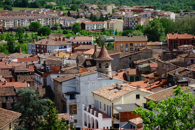
Finally in Vic
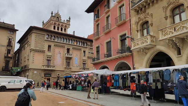
Vic is distinguished by its plaza major; big, unpaved, and preserved in the traditional style. We had just enough energy to go around the city center to check out all the modernismo buildings.
Our 10-week tour of Spain is ending. We loved every bit of it. It was abundantly clear to us, since our previous trip in 2017, Spain has made a lot of progress and is in ascendance.
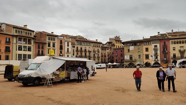
Our first look at Plaza Major on the minor market day.

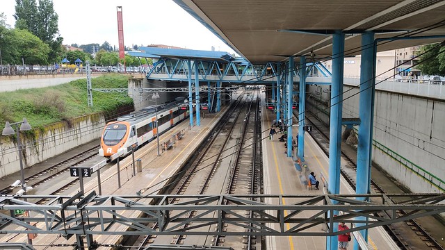
We stayed in a hotel on the 2nd floor of the old train station - just a one minute walk to the tracks.

It rained the afternoon we arrived, but we still walked around town, plus made an appointment for our (then mandatory) COVID-19 test.


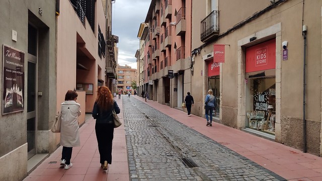
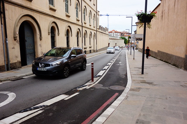
No curbs, few cars downtown.

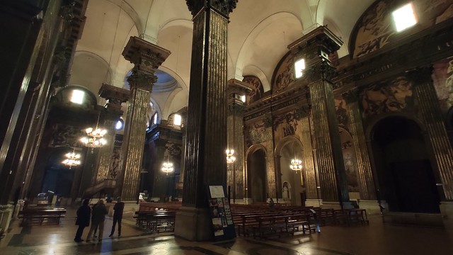
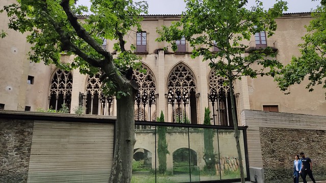
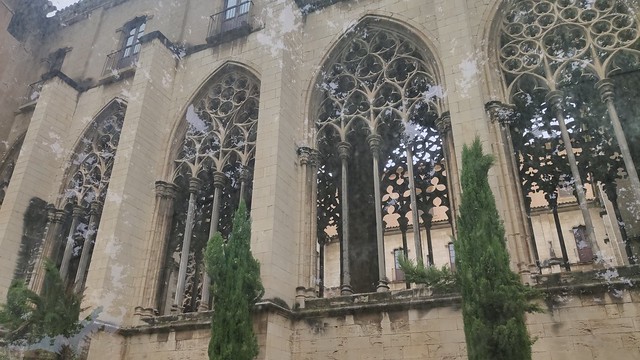
The Cathedral is enormous (with a cloister).

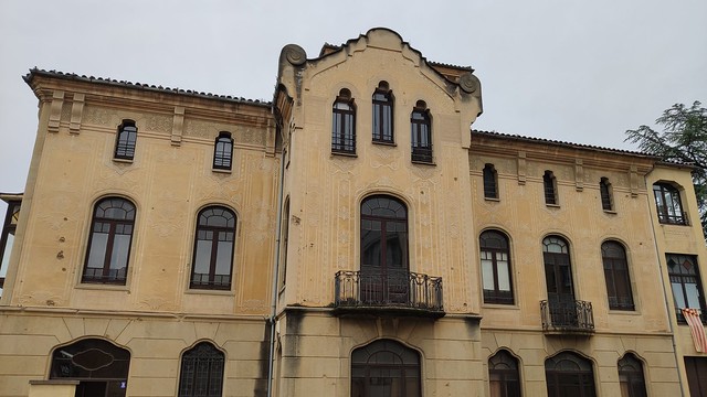
The clinic we used for our covid shot is across the small plaza from the Cathedral. Bonus: it's a beautiful Modernismo building.

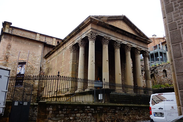
There is a restored Roman Temple in Vic.
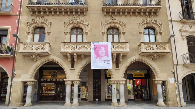
A block of Modernismo buildings.


Small Plaza.

This balcony caught my eye.

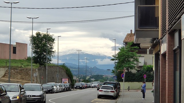
Later in the day we spotted the snow-capped Pryeneese in the distance
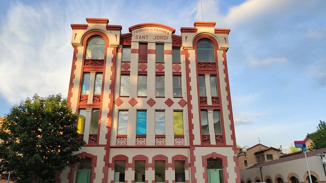
The striking Sant Jordi Building.
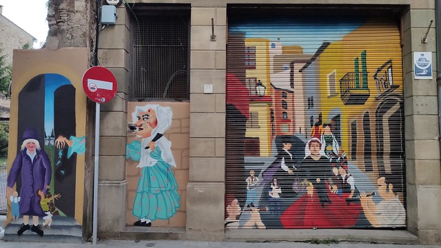
Political murals and graffiti.

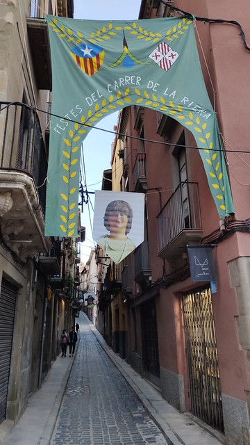
Street festival.

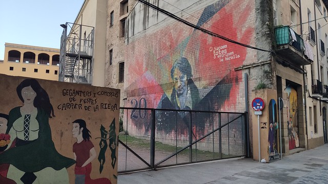
A few more murals.


Our final view of Plaza MaJor.

Monday, August 01, 2022
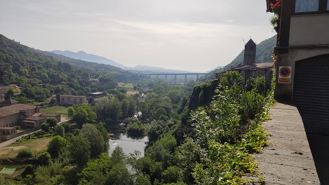
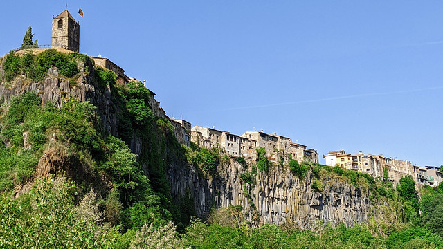
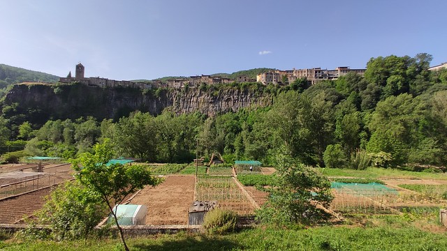
Garrotxa: Castellfollit de la Roca to Olot
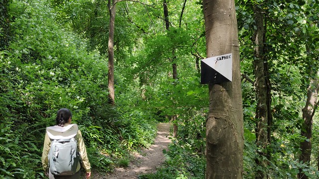
Castellfollit was built on multiple layers of basalt columns resulting from different volcanic eruptions at different points in geological time. Normally the basalt column formation itself would be fascinating enough. Here, there is a whole village perched on top! We followed the Park's Trail 13 circumnavigated the place, up, down, and around.
Then we headed out of town on the main road for a couple of kilometers to the next town, Sant Joan les Fonts. Here, they were having their flower festival. We followed the Park's Trail 16 along the river going west, passing by or on top of more lava flows. We had to cross the river twice, one was so long, it was easily worth 5-10 normal stream crossings. At one spot, the spacing was wider than my jump-stride, John had to pull me across. I was tempted to turn around.
After San Joan, we followed GR 83 towards Olot, going by Garrinada Volcano, to the Montsacopa Volcano. The top is a fantastic view of the town. Since we were in the middle of a heat wave with record high temperatures, I was pooped, but excited to have completed the excursion. See GPS track(s) of our 18.8 km route below.

The Olot Bus Station was 10 minutes from our apartment. New and modern. In general the bus transport in Spain is very good even though there is NO competition between companies for routes.

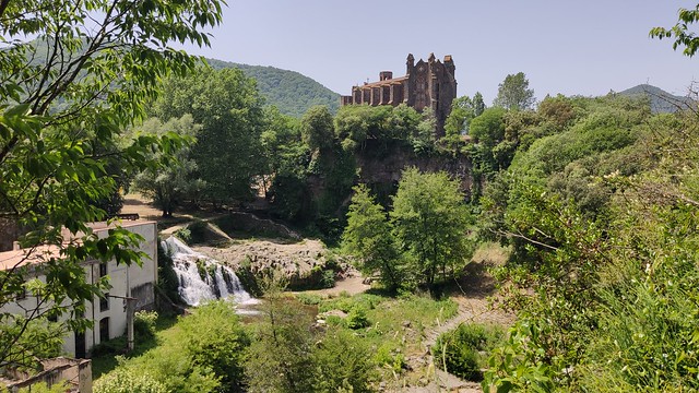
We rode the bus about 20 minutes to Castellfollit de la Roca, getting off at the top of the town that is perched on top of a mass of basalt columns which you can't see until you walk down to the river.
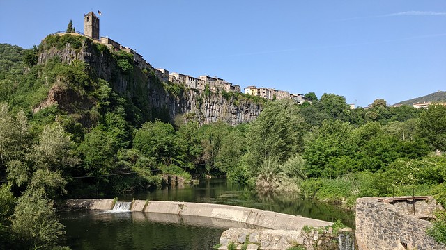
The trail crosses the river - great views - and cirlcles back up to town.


Passing a water channel/canal with a memorable "Stick Figure in Peril" sign.

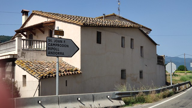
John was excited to see this road sign pointing to Andorra, just 140 kms to the northwest. But, sigh, Andorra will have to wait until another trip.
It's a nice walk from Castellfollit to Sant Joan les Fonts, a short section on the road shoulder and then a walk on a greenway passing several fruit companies.
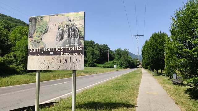


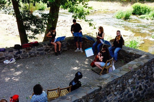
Sant Joan surprised us with a Flower Festival with floral displays, young rockers belting out a fine cover of "American Woman", and a string quintet by the river.


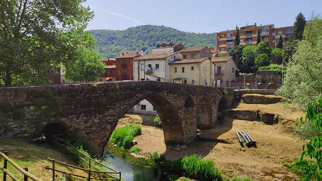
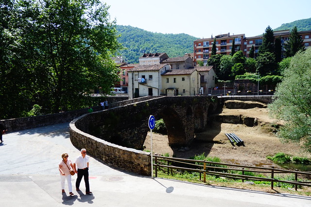
The medieval bridge, built with volcanic stone, crosses the river Fluvià (from Wikipedia).

The best place in town to view the triple layers of lava is near the old factories.


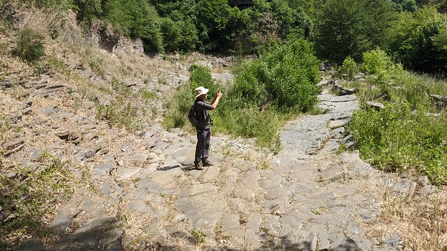
I'm standing on top of a dry riverbed of basalt column tops.


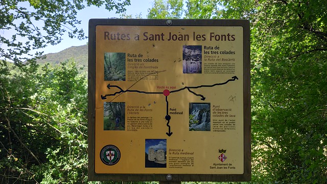
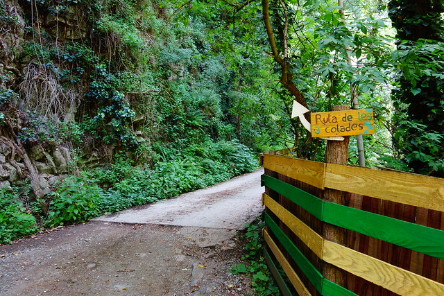
Pick your route.

Our route back to Olot from Sant Joan.

Mirador.
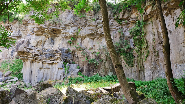
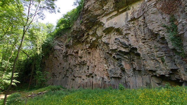
At this old quarry one can see 3 distinct lava flows. The difference in the shapes of the rocks is due to the relative speed at which the lava cooled; the basalt columns at the bottom cooled the slowest. Not only is it instructive, it's beautiful.

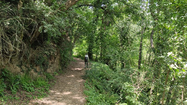
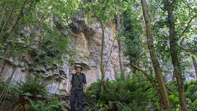
The trail west along the Fluvia to Cingles (Cliffs) de Fontfreda was lush, hot but not humid.
And more basalt columns at the Cliffs of Fontfreda. Wow!


A couple of long stream crossings later (below, the shortest one), we walked up out of the river valley and headed south to Olot.


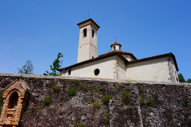
After trudging up the backside of Volcà del Montsacopa to Església de Sant Francesc, we were rewarded with a pretty good view down to Olot.

Most Recent Post
Corsica: Calvi
From Bastia we took the train to Calvi at the northwest of the island. As the train tracks were being repaired, we actually spent more time ...

Most Popular Posts of Last 30 Days
-
When Indigo airlines canceled our Colombo-Hyderabad flight, we took India and Pakistan off our itinerary. Considering we are in the 10th yea...
-
Wuxi, situated just 26 miles from Suzhou, is another ancient city boasting a written history dating back 3000 years. It is also the cradle o...
-
From Yining, China, we began a somewhat difficult two-day journey to Karakol, Kyrgyzstan via Zharkent, Kazakhstan. The easy route would hav...
-
We are starting our spring travel! From Raleigh, a direct flight to Frankfurt, another to Tunis, taxi to Tunis North Bus Station, a 2.5 ho...
-
Bogota, at 8,650 feet above sea level, poses no altitude problem for us having acclimatized in Tunja (9200 ft), but we were not expecting s...
-
On the way from Tabarka to El Kef, we stopped to visit the Roman archeological site of Bulla Regia. Thought to be the capital of one of the ...
-
On our way from El Kef to Tunis, we stopped at Dougga, a UNESCO archeological site. The last time we came to Tunis we were not confident eno...


